
Also much more of the Grandline, as they only traveled down one path. Also, assuming the series doesn't end with Luffy's execution or something of the sort, we can assume it'll probably end on a light-hearted note, such as them heading off to another adventure. Cut to timeskip years later, with Nami's full map.
One Piece Geography
-
-
My friend was rereading the manga and figured out a few things. Like, what route the Strawhats took and why they didn't change to another route at all.
Igaram sent the Strawhats and Vivi with the Loge Pose and told them that it will take them two or three stops to get to Arabasta.
Igaram: While the Baroque Works agents are following me…
...you will get on their ship and take the normal course to Alabasta.
I have never done it myself, but I believe you can follow the Log two or three times to get there.How do we know what islands that route has?
When Robin met them, she offered them an Eternal Pose to an uninhabited island right before Arabasta.Miss All-Sunday: Now you can skip all of that.
That needle points to the uninhabited island right before Alabasta.Then they arrived to Little Garden, which is the second island of that route. So that uninhabited island must be the 3rd or the 4th island, as Igaram said that there'll be two or three stops before Arabasta.
How do we know that Skypiea is next, after Arabasta?
crocus: Are you sure you want to choose Whiskey Peak entirely on their behalf, boy?
There's only one place where you can decide where to head next, and that's here.Luffy: If we don't like it the first time, we'll just sail all the way through and start over.
So no matter what, Arabasta will always point to Skypiea.
How do we know that their route looks like? Oda drew two maps so far, both are pretty much the same despite having a gap of 400 chapters between the chapters they were shown in.
!

!
There're 8 islands in that route:
- Whisky Peak, 2) Little Garden, 3) Drum Island, 4) the uninhabitated island, 5) Arabasta, 6) Skypiea, 7) LRLL and 8) Water 7
But he's not sure about Drum. It could come in after Little Garden and before the uninhabitated island or it could be that small island of the route left to our route because it's on the way to Arabasta.
Jaya is outside of their route and they got there thanks to the Saruyama brothers.
So, what do you think?
- Whisky Peak, 2) Little Garden, 3) Drum Island, 4) the uninhabitated island, 5) Arabasta, 6) Skypiea, 7) LRLL and 8) Water 7
-
I wouldn't put
muchany stock into that map Oda sketched out. I'm sure it isn't meant to accurately depict the amount of islands and location of islands on the paths– though Oda is certainly capable of forcing it. The main reason you shouldn't use it as a reference is because we already passed it up and it was never relevant. We won't be returning to that portion of the Grand Line, especially to explore, so the accuracy of the paths and other options can never really be explored or verified. It's a nice theory, with some kinks in it-- for example, Drum was found because they deviated from the path-- but beyond that...? Have you taken a look at the discussion in this thread or the timeline thread? You'd probably find them both interesting. -
Well, yeah, it doesn't change much but it still interesting to know that Oda probably thought of it when he drew the map.
-
The strawhats route was all screwed up. You mention Igaram and his 3-4 stops, he "BELIEVES" This is in no way definitive as being fact.
All it proves is that Arabasta was on their original path they took.
So lets say the 7 paths are labeled 1-7. They took say path 3. We know that these islands are on path 3, IF Igaram was right.
3. Whiskey Peak, Little Garden, Arabasta.
That is it. The rest could be on other paths. They blindly found drum, so it could have been on a different path and then they got back on 3 by following the eternal pose to arabasta.
Then in regards to skypiea, the pose wasn't originally pointing there, it was pointing somewhere else. Could this somewhere else have been Jaya? We don't know. I think it might have been, cause otherwise how would the log change. I think it was originally pointing at Jaya, but the ship falling somehow tweaked the pose to point at the other half of Jaya. Then on Skypiea the log set to the next island Long Ring, then on to Water 7, then Fishman Island.
BUT that is pure guessing. We don't know if the log wouldn't have changed if they would have ended up at Jaya or some other island. We also don't know if letting the log pose adjust on Jaya and Skypiea both lead to the same place. They were once one and same, but they aren't now, so Skypiea may lead to somewhere that Jaya doesn't.

-
Then in regards to skypiea, the pose wasn't originally pointing there, it was pointing somewhere else. Could this somewhere else have been Jaya? We don't know. I think it might have been, cause otherwise how would the log change. I think it was originally pointing at Jaya, but the ship falling somehow tweaked the pose to point at the other half of Jaya. Then on Skypiea the log set to the next island Long Ring, then on to Water 7, then Fishman Island.
I didn't remember that so I went back to read. http://www.mangareader.net/103-2325-13/one-piece/chapter-218.html after Arabastra its pointing is horizontal to horizon, then a few pages later the ship falls and immediately after the needle of the log pose is pointing up. http://www.mangareader.net/103-2325-18/one-piece/chapter-218.html
Before the ship fell it log pose was pointing to Jaya, then after ship fell it pointed upwards. What I think happened is the ship either had rocks from Upper yard on it so when it fell the pose registered it or when ship landed the waves moved the Merry Go around alot and it got directly under Skypedia there fore Upper Yard, so then the pose registered it instead of Jaya.
BUT that is pure guessing. We don't know if the log wouldn't have changed if they would have ended up at Jaya or some other island. We also don't know if letting the log pose adjust on Jaya and Skypiea both lead to the same place. They were once one and same, but they aren't now, so Skypiea may lead to somewhere that Jaya doesn't.
Sorry that part doesn't make sense. When the log pose was introduced, it was siad its the mineral makeup of the island is what gives it its unique magnetic setting. Since Upper Yard in Skypeia was once part of Jaya, it has the same mineral makeup and same magnetic reading, and there fore point to same island after it.
-
do you guys think the next island gonna be a summer island?

-
Well this whitestrom… Was it ever mentioned before and what do you think... Will it play a role later on?
Maybe this is the reason why Laboon was seperated from his group
-
@RPG:
do you guys think the next island gonna be a summer island?
It's anyone's guess at this point.
As for the White Strom chances are we'll here about it again when they have to travel under water the next time.
-
Nami was on Weatheria for 2 YEARS, how come her log pose still points to Fisherman Island?
-
Weatheria was just a cloud island, wasn't it? I don't think it had a charge like Skypeia (The logpose was pointing to God's Varse).
-
This is my idea of Grand Line:
The route taken by Strawhats:
from Whisky Peek to Little Garden they follow the log pose, later to Drum (without follow the log, but by chance); From Drum to Arabasta.. they follow an Eternal Pose. in Arabasta the magnetism is recording and carry on until water 7Considerations:
- It is not sure where either someone tells Marijoa center red line.
- The archipelago Sabaody is exactly in the middle?
3)Marineford is near to the archipelago Sabaody? - the 3 islands are located on the right government of the Grand Line, one of these Impel Down is on the Calm Belt.
- Marijoa is located exactly above Marineford
- Enies Lobby is approximately 3-4 hours from Water 7
- if water 7 is near EL which at the same time is near calm belt then the route chosen by the crew is the right most one

Visita il [ROLONOAZORO FORUM
Il Canale Youtube dell' RZ e Verba Team](http://www.youtube.com/channel/UCwsqwXKjpsvXVuUDG8_TUSA)

-
Let's see if I remember this correctly
1. Nobody has ever stated that Mariejoa is right at the center of Red line. But Hody did say by taking Fishman Island (which is directly below Mariejoa), they are taking the center of the world. Although we can't be sure whether he meant figuratively or literally.
2. No confirmation on that one wither
3. Yes, it was repeatedly stated that it wouldn't take long to reach Shabondy from Marineford
4. I don't really remember if it was said that the 3 Govt. Islands was on the right side
5. I don't think so. As far as I know, Mariejoa is right above Fishman Island, an we don't actually see any sign of the Red Line anywhere near Marineford
6. Yep
7. Umm. Don't really know about this one -
^
All the maps of the Red Line, Marineford, Shabondy show it as it is in the right Calm Belt.And Drum must be on the Strawhats' route since Ace was expecting them to arrive there in 10 days.
-
^
All the maps of the Red Line, Marineford, Shabondy show it as it is in the right Calm Belt.And Drum must be on the Strawhats' route since Ace was expecting them to arrive there in 10 days.
I don't think
From little garden to Arabasta use Eternal Pose, but nami is ill, and seeking an island…finding Drum Island!
Ace could not foresee that they were going to Drum...
The obvious solution is the one I described :happy:Visita il [ROLONOAZORO FORUM
Il Canale Youtube dell' RZ e Verba Team](http://www.youtube.com/channel/UCwsqwXKjpsvXVuUDG8_TUSA)
-
This post is deleted!
-
New world map from last Jump issue (I think from mini-book "One Piece 15th – Dive to Grand World") with new location names, thanks Greg in The One Piece Podcast.
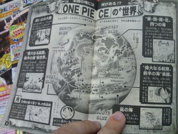
New location names:
Sambas sea region (near Baratie) サンバス
Polestar Archipelago (location of Logue Town)
Yotsuba Island (Location of Shells Town)

Twitter: https://twitter.com/Mugiwara_23
-
Nice map, thanks for posting it redon!
-
Grand Line Paradice? :ninja:
-
This post is deleted!
-
Between the two Carm Belts
FC(3DS) - 2724-4238-5489 (LZTan)
FC(Switch) - SW-3434-4042-7728 (Jin)
-
A really interesting map! thanks to Greg and Redon for all the info and the image.
Looking at what we have now it appears that parts of the red line (specifically the part between east blue and north blue) are pretty flat so that could easily explain how ordinary people can travel between certain blues. So I'm guessing that's how Sanji came from North Blue to East Blue back when he was a kid.
-
this map makes me think that after One Piece, Oda will focus on Red Line and tell us another story. A prequel possibly?
Is there a better version of this map`?
-
So is that all? :(
I was expecting more of the map. Oh well.
-
Dissapointed as well, we only know the name of the island where Loge Town is, the sea where Baratie is, and I'm pretty sure that we already had Yotsuba island before this.
-
Damn, Red Line is MASSIVE.
I always thought Red Line is a mere land version of Grand Line, how wrong I was.
-
Thanks redon & OP Podcast. This is uber cool, changes my perspective on a lot of things. Red Line truly is massive.
-
Thanks Redon & Greg. This is amazing, now need for better quality.
We'll probably see the other side after One Piece is finished.
-
Kinda disappointing that we still don't get a map of Paradise. Oh well, it's still cool to get a better idea of what the Red Line's geography looks like. Interesting that it only seems to be highly mountainous near where it intersects with the Grand Line.
-
Paradice.
Paradise.
See the difference?
:ninja:
-
I hope Nami, I mean Oda, makes a really awesome world map at the end of One Piece that I can mount on the living room of wherever I'll be living by then. World maps are classier for living rooms than straight-up posters or pictures, which belong in my room.
Paradice.
Paradise.See the difference?
:ninja:
PAIR O' DICE!
Actually really fitting since making it out alive in the Grand Line is a roll of the dice.
-
A really interesting map! thanks to Greg and Redon for all the info and the image.
Looking at what we have now it appears that parts of the red line (specifically the part between east blue and north blue) are pretty flat so that could easily explain how ordinary people can travel between certain blues. So I'm guessing that's how Sanji came from North Blue to East Blue back when he was a kid.
Mariejois is connected to all Blues and the Grand Line, too.
-
This post is deleted!
-
There are only 2 red lines and between them is the first half of the grand line right? And outside of them is the new world?
-
There are only 2 red lines and between them is the first half of the grand line right? And outside of them is the new world?
There's actually one Red Line that encompasses the whole world, so the Grand Line is Split into two pieces. The first half is nicknamed Paradise, the second half is nicknamed the New World, but they're both part of the Grand Line.
And the four pieces that the Red Line and Grand Line separate the earth are the Four Blues.
Here's a good picture.

Originally Posted by Nightwing
Stay focused, cause right now you have a decision to make. Are you a man perpetually looking back at what he’s lost, or a man looking forward, to what he might become?
-
There's actually one Red Line that encompasses the whole world, so the Grand Line is Split into two pieces. The first half is nicknamed Paradise, the second half is nicknamed the New World, but they're both part of the Grand Line.
Yea but why are the 2 red lines so close to each other. Does that mean the Paradise is alot smaller than the the New World?
-
Yea but why are the 2 red lines so close to each other. Does that mean the Paradise is alot smaller than the the New World?
They're not and it's not, the globe in Gizmo's picture is just transparent.
-
They're not and it's not, the globe in Gizmo's picture is just transparent.
Oh it's transparent? Lol now i get it!
-
The funny thing is that my original post was to prove otherwise.Anyway, welcome to this post where I'll mention some points regarding the World of One Piece and the position of Punk Hazard.1- Something very simple yet very important to my second point and it's something that I've misunderstood before.
[hide] [/hide]If we look at this map like we look at normal maps (like a rectangular map rather than spherical), then we can use a compass that works just like compasses in the real world.
[hide] [/hide]As we can see, sailing the Grand line is basically sailing towards the South-East.
This will lead me to my second point in which we find out the location of Punk Hazard from the first three islands in the New World. For this, we're going to use two facts straight from the manga.
[hide]
 [/hide]From this, we know that Raijin Island is the island in the middle. Knowing that, we follow Smoker's track to Punk Hazard, which will tell us where he came from and towards which direction did he sail.
[hide] [/hide]For Smoker to reach the North-West Coast he needs to be heading South-East. Meaning, he was sailing deep into the New World.
Conclusion: Punk Hazard's location is after the first three islands of the New World and the Strawhats reached it thanks to what happened after leaving Fishmen Island. This could mean that they won't comeback to these Islands and that the next island the Strawhats visit may not be via their log pose.
What is Oden saying to WB?
Become my son Whitebeard.
-
The funny thing is that my original post was to prove otherwise.Anyway, welcome to this post where I'll mention some points regarding the World of One Piece and the position of Punk Hazard.1- Something very simple yet very important to my second point and it's something that I've misunderstood before.
[hide][/hide]If we look at this map like we look at normal maps (like a rectangular map rather than spherical), then we can use a compass that works just like compasses in the real world.
[hide] [/hide]As we can see, sailing the Grand line is basically sailing towards the South-East.
This will lead me to my second point in which we find out the location of Punk Hazard from the first three islands in the New World. For this, we're going to use two facts straight from the manga.
[hide][/hide]From this, we know that Raijin Island is the island in the middle. Knowing that, we follow Smoker's track to Punk Hazard, which will tell us where he came from and towards which direction did he sail.
[hide][/hide]For Smoker to reach the North-West Coast he needs to be heading South-East. Meaning, he was sailing deep into the New World.Conclusion: Punk Hazard's location is after the first three islands of the New World and the Strawhats reached it thanks to what happened after leaving Fishmen Island. This could mean that they won't comeback to these Islands and that the next island the Strawhats visit may not be via their log pose.
Damn, this is probably one of the most useful and helpful posts I've seen here in a while. This stuff just zips right over my head while reading..

I wonder which direction Dressrosa and Wano are.. -
Here's a picture I made with all the New World islands we've seen:
!

-
The funny thing is that my original post was to prove otherwise.Anyway, welcome to this post where I'll mention some points regarding the World of One Piece and the position of Punk Hazard.1- Something very simple yet very important to my second point and it's something that I've misunderstood before.
[hide]http://img17.imageshack.us/img17/7089/opnsewbluept81.jpg[/hide]If we look at this map like we look at normal maps (like a rectangular map rather than spherical), then we can use a compass that works just like compasses in the real world.
[hide]http://img254.imageshack.us/img254/932/opnsewbluept8.jpg[/hide]As we can see, sailing the Grand line is basically sailing towards the South-East.This will lead me to my second point in which we find out the location of Punk Hazard from the first three islands in the New World. For this, we're going to use two facts straight from the manga.
[hide]http://img171.imageshack.us/img171/8397/op66170.pnghttp://img254.imageshack.us/img254/8265/op66131.png[/hide]From this, we know that Raijin Island is the island in the middle. Knowing that, we follow Smoker's track to Punk Hazard, which will tell us where he came from and towards which direction did he sail.
[hide]http://img690.imageshack.us/img690/5499/op67042.png[/hide]For Smoker to reach the North-West Coast he needs to be heading South-East. Meaning, he was sailing deep into the New World.Conclusion: Punk Hazard's location is after the first three islands of the New World and the Strawhats reached it thanks to what happened after leaving Fishmen Island. This could mean that they won't comeback to these Islands and that the next island the Strawhats visit may not be via their log pose.
Excellent observation!
There's also this detail:
http://www.mangahere.com/manga/one_piece/v50/c491/10.htmlI think we can figure out the distance from Shabondy to the Red Line using this. To me it looks like 15 km, probably a bit more.

-
Excellent observation!
There's also this detail:
http://www.mangahere.com/manga/one_piece/v50/c491/10.htmlI think we can figure out the distance from Shabondy to the Red Line using this. To me it looks like 15 km, probably a bit more.
You're right, it should be around that distance.
-
!

Posting this here too.
Thee following places have been named:
Raftel
Wano
Punk Hazard
Dressrosa
Risky Red
Mistoria
Raijin
Green Bit
Foodvalten
Yukiryuu
Whole Cake
Elbaf (is it in New World?)
ZouThe island I've marked as "Mistoria island?" is the island where Kid was seen before the TS. It would make sense because Kid couln't have gotten very far at that point, and the island looks kinda "mysterious".
-
Yea but why are the 2 red lines so close to each other. Does that mean the Paradise is alot smaller than the the New World?
To put it simpler, you know what the equator and prime meridian are right?
Imagine one of them as being a solid continent, that's the Red Line. A long thin continent that goes around the entire world like a snake.
Now imagine there's a sea route going around the world too, the entire world. It's isolated from the rest of the oceans by strange weather and other natural mysteries. This sea route is the Grand Line.This sea route is crossed by the huge continent at two points, meaning it's cut in two.
One of those halves that goes around half the world is the Paradise part, the first part. The other half is the New World, second part.So these two lines, one continent, one sea, cross the world like a big X. Which leaves four areas of ocean between them, these are the Blues.
-
The funny thing is that my original post was to prove otherwise.Anyway, welcome to this post where I'll mention some points regarding the World of One Piece and the position of Punk Hazard.1- Something very simple yet very important to my second point and it's something that I've misunderstood before.
[hide][qimg]http://img17.imageshack.us/img17/7089/opnsewbluept81.jpg[/qimg][/hide]If we look at this map like we look at normal maps (like a rectangular map rather than spherical), then we can use a compass that works just like compasses in the real world.
[hide][qimg]http://img254.imageshack.us/img254/932/opnsewbluept8.jpg[/qimg][/hide]As we can see, sailing the Grand line is basically sailing towards the South-East.This will lead me to my second point in which we find out the location of Punk Hazard from the first three islands in the New World. For this, we're going to use two facts straight from the manga.
[hide][qimg]http://img171.imageshack.us/img171/8397/op66170.png[/qimg][qimg]http://img254.imageshack.us/img254/8265/op66131.png[/qimg][/hide]From this, we know that Raijin Island is the island in the middle. Knowing that, we follow Smoker's track to Punk Hazard, which will tell us where he came from and towards which direction did he sail.
[hide][qimg]http://img690.imageshack.us/img690/5499/op67042.png[/qimg][/hide]For Smoker to reach the North-West Coast he needs to be heading South-East. Meaning, he was sailing deep into the New World.Conclusion: Punk Hazard's location is after the first three islands of the New World and the Strawhats reached it thanks to what happened after leaving Fishmen Island. This could mean that they won't comeback to these Islands and that the next island the Strawhats visit may not be via their log pose.
WTF! I always thought the red line was vertical.
-
WTF! I always thought the red line was vertical.
If the Blues are compass directions than it can't be. It makes more sense for it to be like Asm says.
-
WTF! I always thought the red line was vertical.
@Monkey:
If the Blues are compass directions than it can't be. It makes more sense for it to be like Asm says.
Yeah, I went with that assumption at the time since it's the most obvious one. Then I checked back to previous chapters and found this which pretty much confirmed for me.
-
!
Posting this here too.
<fancy list="" of="" islands="">The island I've marked as "Mistoria island?" is the island where Kid was seen before the TS. It would make sense because Kid couln't have gotten very far at that point, and the island looks kinda "mysterious".</fancy>
I suddenly remembered, didn't you forget the island Capone Bege came to when he went to the New World?
or was that thing not an island you think?! 


